Source of the Nile

Hike to see the rare mountain gorillas in a misty rainforest.

Source of the Nile

The dense forests of Bwindi Impenetrable National Park are located in southwestern Uganda, on the edge of the rift valley. The area is a typical tropical rain forest with an annual temperature range of 7–15°C minimum to 20–27°C maximum. Its annual rainfall ranges from 1,400 to 1,900 millimeters. The heaviest rains occur from March to April and from September to November. The forest plays a key role in regulating the outside area’s environment and climate.

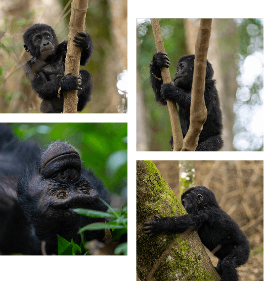
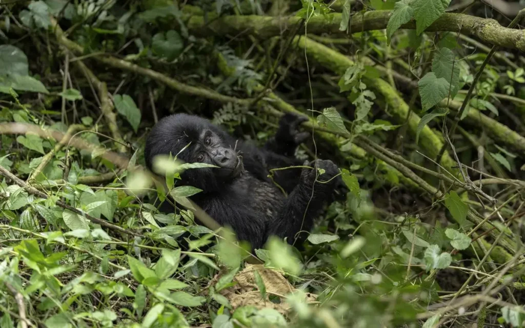
Bwindi Impenetrable National Park was designated as a national park in 1991. In 1994 it was listed as a UNESCO world heritage site because of its ecological importance. The lush forest became known to the world because of gorilla tracking, providing a habitat for around half of the world’s remaining mountain gorilla population. These gentle primates are a highly endangered species and the forest is home to an estimated 400 of the 800 or so mountain gorillas in the entire world. They are highly endangered because of poaching, habitat loss and disease. This national park generates one of the highest revenues to Uganda Wildlife Authority among all the safari parks in Uganda. Gorilla tracking here requires a permit, the proceeds from which goes towards the further conservation of mountain gorillas. Try to look at the money you spend on permits from the perspective of helping these endangered mountain gorillas grow and multiply in numbers.

Species diversity:
The forest’s mist-covered hillsides are blanketed by one of Uganda’s oldest and most biologically diverse rainforests, which dates back over 25,000 years and contains almost 400 species of plants.
This biologically diverse region also provides shelter to a further 120 mammals, including several primate species such as baboons and chimpanzees, as well as elephants and antelopes. There are also around 350 species of birds hosted in this forest, including 23 Albertine Rift endemics. The park is a sanctuary for Colobus monkeys and chimpanzees and the endangered mountain gorillas. Several groups of gorilla have been habituated and can be tracked.

Size and accessibility:
Bwindi National Park covers an area of 331 square kilometres and is located in the highest parts of Kigezi highlands, with an altitude of 1,190 to 2,607 meters above sea level. 60% of this magical park has an elevation of over 2,000 meters above sea level. Bwindi currently has six sectors, namely Buhoma, Nkuringo, Ruhija, Rushaga, Nyundo and Rubugiri.

By Car:
Bwindi can be reached from Queen Elizabeth National Park to the north (2-3 hours), from Kabale to the south (1-2 hours), or from Kampala via Mbarara (6-8 hours). The roads meet at Butogota, 17 km from the Buhoma entrance gate. A 4WD vehicle is necessary during the rainy season.

By Air:
Travellers can fly from Entebbe to the modern tarmac airstrip at Kisoro. Those going to track gorillas in the northern sector may use Kihihi airstrip.

Activities:
Gorilla tracking
Bird watching
Nature walk

Experience With Kikooko

Kampala

Discover Uganda’s capital city, bustling with markets, nightlife, and cultural attractions.

Kampala

Kampala, the capital and largest city of Uganda has a rich history. It is worth finding out about the Buganda Kingdom and the fascinating palaces and compounds from where the nation was run before the arrival of colonialism. The Kasubi Tombs (built in 1881), the Lubiri Palace, the Buganda Parliament and the Buganda Court of Justice have survived the tests of time and can be visited. In 1890, British colonial administrator Frederick Lugard constructed a fort on Mengo Hill within the city, which allowed for the British to occupy much of the territory controlled by the Baganda, including Kampala. In 1894, the British government officially established a protectorate within this territory. In 1905, the British government formally declared the entire territory to be a British protectorate. From that time until the independence of the country in 1962, the capital was relocated to Entebbe, although the city continued to be the primary economic and manufacturing location within Uganda.

Kampala was once the city of seven hills, now it occupies a series of hills at an elevation of about 1,190 metres and is situated in the southern part of the country, just north of Lake Victoria. The city has numerous food production, metal-products, and furniture manufacturing enterprises and a tractor-assembly plant. It is the headquarters for most of Uganda’s large firms. Kampala has a technical institute and is the seat of Makerere University, which was founded in 1922 and became a university college in 1949 and a university in 1970.  For many years it was the only such educational institution in East Africa. Kampala also has the Uganda Museum. The city is home to several mosques (including the white Kibuli Mosque), Hindu temples, and Christian churches.

Kampala has been ranked the best city to live in East Africa, ahead of Nairobi and Kigali, by Mercer, a global development consulting agency based in New York City. The population is over 2 million and it is the 13th fastest growing city on the planet.

While the city does not have clear rainy and dry seasons, it generally experiences heavier rainfall from February to April, with April typically seeing the heaviest. It has a tropical rainforest climate and is therefore perfect to visit all year round.

Accessibility:
By car:
From the international Airport in Entebbe it is about 1 hour drive to the city, depending on the traffic.

By air:
The international airport is in Entebbe and operates domestic (small aircraft) and international flights.

Activities:
City Tours
Day trips from Kampala
Museum
Parks
Shopping
Dining
Golf Course
Vegetable Market

Experience With Kikooko

Bwindi Impenetrable National Park

Hike to see the rare mountain gorillas in a misty rainforest.

Bwindi Impenetrable National Park

The dense forests of Bwindi Impenetrable National Park are located in southwestern Uganda, on the edge of the rift valley. The area is a typical tropical rain forest with an annual temperature range of 7–15°C minimum to 20–27°C maximum. Its annual rainfall ranges from 1,400 to 1,900 millimeters. The heaviest rains occur from March to April and from September to November. The forest plays a key role in regulating the outside area’s environment and climate.

Bwindi Impenetrable National Park was designated as a national park in 1991. In 1994 it was listed as a UNESCO world heritage site because of its ecological importance. The lush forest became known to the world because of gorilla tracking, providing a habitat for around half of the world’s remaining mountain gorilla population. These gentle primates are a highly endangered species and the forest is home to an estimated 400 of the 800 or so mountain gorillas in the entire world. They are highly endangered because of poaching, habitat loss and disease. This national park generates one of the highest revenues to Uganda Wildlife Authority among all the safari parks in Uganda. Gorilla tracking here requires a permit, the proceeds from which goes towards the further conservation of mountain gorillas. Try to look at the money you spend on permits from the perspective of helping these endangered mountain gorillas grow and multiply in numbers.

Species diversity:
The forest’s mist-covered hillsides are blanketed by one of Uganda’s oldest and most biologically diverse rainforests, which dates back over 25,000 years and contains almost 400 species of plants.
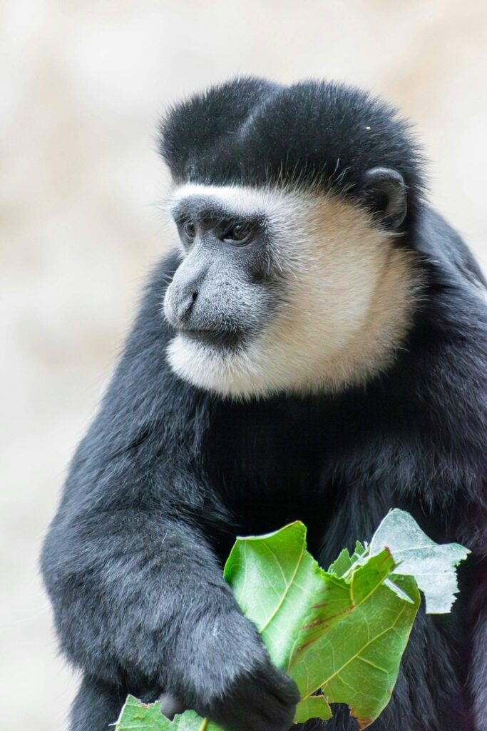
This biologically diverse region also provides shelter to a further 120 mammals, including several primate species such as baboons and chimpanzees, as well as elephants and antelopes. There are also around 350 species of birds hosted in this forest, including 23 Albertine Rift endemics. The park is a sanctuary for Colobus monkeys and chimpanzees and the endangered mountain gorillas. Several groups of gorilla have been habituated and can be tracked.

Size and accessibility:
Bwindi National Park covers an area of 331 square kilometres and is located in the highest parts of Kigezi highlands, with an altitude of 1,190 to 2,607 meters above sea level. 60% of this magical park has an elevation of over 2,000 meters above sea level. Bwindi currently has six sectors, namely Buhoma, Nkuringo, Ruhija, Rushaga, Nyundo and Rubugiri.

By Car:
Bwindi can be reached from Queen Elizabeth National Park to the north (2-3 hours), from Kabale to the south (1-2 hours), or from Kampala via Mbarara (6-8 hours). The roads meet at Butogota, 17 km from the Buhoma entrance gate. A 4WD vehicle is necessary during the rainy season.

By Air:
Travellers can fly from Entebbe to the modern tarmac airstrip at Kisoro. Those going to track gorillas in the northern sector may use Kihihi airstrip.

Activities:
Gorilla tracking
Bird watching
Nature walk

Experience With Kikooko

Entebbe

Relax on Lake Victoria beaches and visit the wildlife sanctuary and botanical gardens.

Entebbe

Entebbe is perhaps best known for the rescue of 100 hostages at the Entebbe airport in 1976. The town sits on a peninsula on the northern shores of Lake Victoria, about 40 km from Kampala the capitol City. ‘Entebbe means ‘seat’ / ‘chair’ in the local language, Luganda.  Entebbe was the seat of the colonial governor in the early 1900’s and is now the residence and the official office location of the President of Uganda. Entebbe is the seat of power in the country.

Entebbe, with its clean air, botanical gardens, parks and the lake is a nice place to visit and live. From the shores of Lake Victoria trips to the various islands, like Ssese or Ngamba can be booked. Many people from Kampala spend their weekends relaxing in Entebbe.

The historical site in Kigungu where the first Catholic missionaries, Brother Amans and Father Mon Maple Lourdel, landed is in Entebbe.  The town is also home of the oldest golf course in East Africa called Entebbe Golf Club, which was established in 1900.

Entebbe has a tropical rainforest climate. The hottest month is February with an average temperature of 22.8 °C, while the coolest month is July with average temperature of 20.6 °C.

During the day it is safe to walk along the roads around Entebbe, but after dark it is advised to drive to your destination. The safest way to ask for a private taxi, recommended by friends or the hotel.

Accessibility:
By Car:
Entebbe is about 1 hour’s drive from Kampala, sometimes a lot longer because of traffic jam.

By Air:
The international airport is in Entebbe. Both domestic (small aircraft) and international flights are operated by the airport.

Activities:
Entebbe Wildlife Centre (Zoo)
Botanical Gardens
Entebbe Market
Boat trips
Golf

Experience With Kikooko

Fort Portal

Experience rural Uganda’s natural beauty and cultural heritage in the Rwenzori foothills.

Fort Portal

The town lies in the northern foothills of the Rwenzori Mountains about 50 km north of Kasese. It is the only town in Uganda with an English name. It was named after the British Consul General of Zanzibar, Sir Gerald Portal who came to Uganda in 1890s. Fort Portal is an excellent starting point to begin a tour to some of Uganda’s best activities and attractions.

Fort Portal is surrounded by beautiful and diverse nature and scenery. The green hills towards Semuliki National Park, with its hot springs and fascinating wildlife; the dense forest of Kibale Forest with its chimpanzees; the countless crater lakes and the nearby mountains of the Rwenzori Mountains invite you to explore and linger. Queen Elizabeth National Park and Semuliki Wildlife Reserve (Toro) can also be reached easily from Fort Portal. The beautiful Toro Palace is located on a hill above the town and can also be visited.

Fort Portal is famous for its tea. The cool climate makes the tea a high grown and high-quality tea. This tea has many health benefits. These include anti-allergy, anti-oxidation, anti-hypertension, anti-viral, anti-obese, anti-cancer, anti-bacterial, enzyme inhibition and many other human health problems. African tea is one of the most common drinks served in Uganda. Tours to a tea plantation can be arranged.

Accessibility:
By Car:
Fort Portal is about 310 km from Kampala and it takes about 4 hours to reach the town.

By Air:
You can fly to Kasese and drive for about 30 minutes to Fort Portal, or you can fly to Semuliki airstrip and drive for about 1 hour to reach the town.

Activities:
Town Tour
Nature walk (Cave, Waterfalls)
Tea plantation
Chimpanzee tracking in Kibale National Park
Semuliki National Park
Semuliki Wildlife Reserve
Queen Elizabeth National Park
Rwenzori Mountains

Experience With Kikooko

Jinja

Raft, kayak, or bungee jump on the Nile River in Uganda’s adventure capital.

Jinja

Jinja is famous for being home to the source of the Nile, the world’s longest river. It also has the second largest economy in Uganda, with industry basing itself here because of the nearby electric power station at the Owen Falls Dam.

German architect and urban planner Ernst May planned the city under colonial rule in 1948. He designed the urban planning scheme for Kampala as well, creating what he called ‘neighbourhood units’.  Jinja retains its distinctly colonial feel even today.

Souvenir shops are found in Jinja; it’s one of the few places where you can get all kind of African souvenirs, drums, Ugandan guitars, handbags, paintings, African print fabric and many more things ideal as presents.

Jinja is also known as the adventure capital of Uganda, because of the different activities it has to offer, from horseback riding to white water rafting to quad biking and kayaking.

Size and accessibility:
Jinja is the biggest town in the Jinja district, with a population of around 80,000.

By Car:
The 80 km from Kampala takes about 2 hours due to the high volume of traffic using this route.

Activities:
White water rafting
Horseback riding
Quad biking
Kayaking
Source of the Nile

Experience With Kikooko

Kibale National Park

Spot chimpanzees and other primates on guided treks in a biodiverse forest.

Kibale National Park

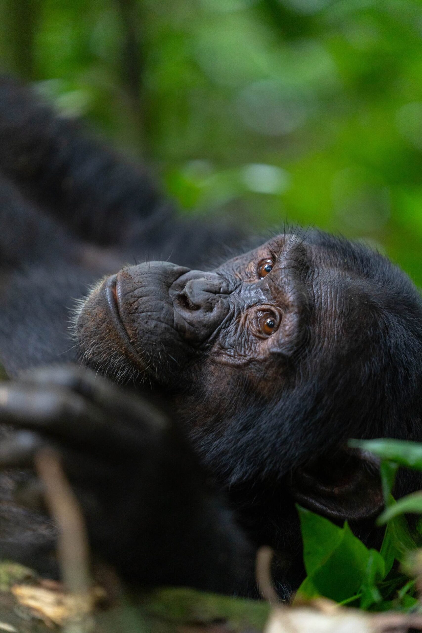
Kibale National Park is the home of the great chimpanzees. It is the most magnificent of Uganda’s tropical rain forests and one of the most rewarding areas to explore. Established at the end of the 18th Century, Kibale boasts 13 species of primates, including the localized Red Colobus and L’Hoest monkeys.

A single group of chimpanzees has been habituated for tourism. Chimp tracking / primate spotting and bird watching are the major tourist activities here. With well-developed nature trails, tourists can enjoy exploring this impressive forest.

Species diversity:
At least 71 species of mammals have been recorded, with leopards, bush pigs, three species of duiker and two species of otter among them.  The forest is also home to 375 species of birds, including African Green-breasted and African Grey Parrots, 250 species of butterflies, 350 species of trees and shrubs, 27 different frogs and toads, and 14 types of snakes. Among the reptiles, the rock python is the largest. The park’s population of elephants travels between Kibale and the Queen Elizabeth National Park.

However, primates dominate the national park. 13 species have been recorded, of which the chimpanzee and the Red Colobus monkey have both been assessed by the International Union for Conservation of Nature (IUCN) as endangered or critically endangered. The rare L’Hoest’s monkey lives in this forest too.

Size and accessibility:
Established in 1993, the park covers 795km² of rainforest, swamps, rivers and a few areas of grassland.

By Car:
The park headquarters, Kanyanchu, is 36km from the nearest town of Fort Portal, while Kampala to Kanyanchu, via Fort Portal, is a distance of 358km.

By Air:
Flying to Kasese and driving to the forest in a 4WD vehicle would be the best option for reducing the travelling time.

Activities:
Chimpanzee tracking
Chimpanzee habituation
Nature walks
Bird watching

Experience With Kikooko

Kidepo Valley National Park

Visit one of Africa’s wildest parks for lions, ostriches, and scenic landscapes.

Kidepo Valley National Park

Kidepo Valley National Park remains, undoubtedly, the most remote and magnificent true wilderness in Uganda.  Tucked away in the north eastern corner of the country, between the borders of South Sudan and Kenya, this serene park’s isolation is part of its beauty.

The park is very much involved in conservation as it protects a wide range of rare, regionally endemic and globally threatened species of wildlife that includes:  ostrich, eland, roan antelope, greater and lesser kudu, dik-dik, African wild dog, cheetah and leopard.  In addition, the bat-eared fox, striped hyena, aardwolf, caracal and cheetah are unique carnivore species of the Karamoja region. The Beisa oryx, roan antelope and Bright’s gazelle have been greatly reduced in numbers as a result of poaching.

The Narus Valley is a wetland area which provides a key source of water within the park.  Its pastures provide a feeding ground for grazers and a hunting ground for carnivores.  This makes the valley a prime game viewing area for tourists.

The Kidepo river is seasonal, alternating between a fascinating sand bed when it’s dry and a full-flowing river after rain.  It can change from one to the other within a matter of hours, especially after rain further north.  The river banks are lined with borassus palms and acacia trees, giving it the feel of a desert oasis.  It’s also the place to look out for the dwarf crocodiles that inhabit the park.

Species and Diversity:
At least 80 species of mammals have been recorded, 28 not known to occur in any other national park in Uganda. Among the animals to be seen here are elephants, zebra, giraffe, eland, buffalo, hyena and lions. 486 bird species also have their home here, including the flightless ostrich and Africa’s largest flying bird, the kori bustard.  Karamoja apalis, Verreaux’s eagle, pygmy falcons and the Egyptian vulture can also be spotted in the park.

Size and Accessibility:
The park covers 1,442km² of the arid Karamoja region.

By Car:
Driving through the vast and unspoiled wilderness of Karamoja to reach Kidepo is an adventure in itself.  However, road conditions are sometimes poor and a 4WD vehicle is essential.

There are a number of possible routes by road, but the most common is Kampala – Karuma – Gulu – Kitgum – Kidepo, a distance of just under 600km, best travelled over two days with an overnight stop in Gulu or Kitgum.

By Air:
Flights to Kidepo take about two hours. There are regular flights or charters possible. A minimum of 4 passengers is required.

Activities:
Game drives
Bird watching
Nature walks

Experience With Kikooko

Lake Mburo National Park

Enjoy an easy-to-reach savanna park for wildlife and water activities.

Lake Mburo National Park

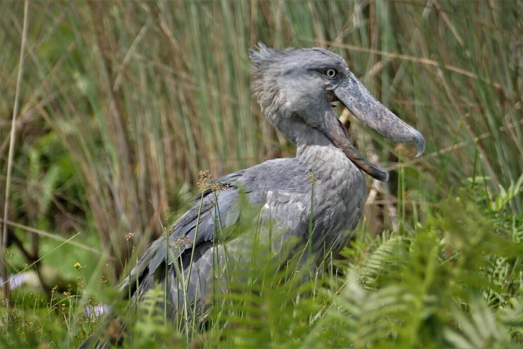
Lake Mburo National Park is Uganda’s second smallest park, characterized by gallery forest, open savannah and acacia woodland, rock kopjes, seasonal and permanent swamps, and open water. This diversity provides a suitable ecosystem for a wide range of fauna and flora. Lake Mburo National Park enjoys a tropical climate. Six swamp-interconnected lakes are home to a variety of water birds including the rare and endangered African finfoot and shoebill.

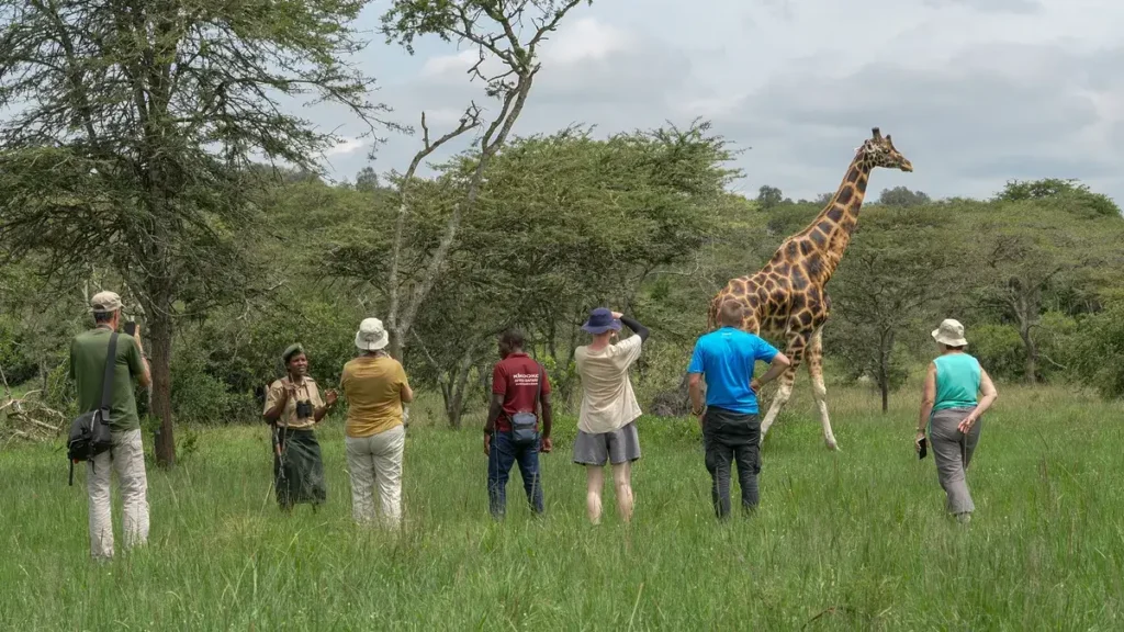
What makes this park even more special is the opportunity to experience walking, cycling or horseback safaris.

Species diversity:
The impala, slender mongoose and bush rat, found nowhere else in Uganda, are conserved here. A small population of klipspringer remains around a few isolated rocky outcrops.

325 bird species and 68 mammal species have been recorded.

On boat trips you come close to hippos, Nile crocodiles and water birds. On a game drive you can see large mammals including impala, buffalo, bush-bucks, water-bucks, monkeys, oribi, duikers, klipspringer, bush babies, dwarf mongoose, and the shy and elusive sitatunga. Lake Mburo is home to the largest population of zebra in Uganda.

The park also supports many endangered species of birds, providing refugee to over 22 species of Palaearctic, as well as Afrotropical migrant birds in the wooded savannah, acacia thickets and grasslands.  The lake itself is also home to the endangered cichlid fish species.

Size and accessibility:
The park lies in western Uganda and is 370 km² in size. It’s approximately 255 km from Kampala and 55 km from Mbarara.

By Car:
Lake Mburo National Park can be reached in 4 to 5 hours from Kampala. It is advised to use a 4WD vehicle.

Activities:
Game drives
Bird watching
Boat tours
Game exploration on foot, on horseback or by bicycle

Experience With Kikooko

Mgahinga Gorilla National Park

Hike to see mountain gorillas and visit the Batwa people in a volcanic landscape.

Mgahinga Gorilla National Park

Mgahinga Gorilla National Park is Uganda’s smallest national park (33.7 km²), however, it is also one of the most dramatic. The park lies on the northern slopes of Mt. Muhabura, Mgahinga and Sabyinyo; three volcanoes that create an unforgettable regional backdrop. These peaks are three of the six Virunga volcanoes that mark the southern limit of the Albertine Rift Valley and divide Uganda, Rwanda and DR Congo. The Virunga are home to more than half of the world’s population of the endangered mountain gorilla. 380 Individuals roam the slopes of the volcanoes while the remaining 340 live nearby in Uganda’s Bwindi Impenetrable National Park. Fortunately for the gorillas, Mgahinga’s small area is supplemented by two larger, adjoining parks in Rwanda (Volcanoes NP) and DR Congo (Virunga NP).

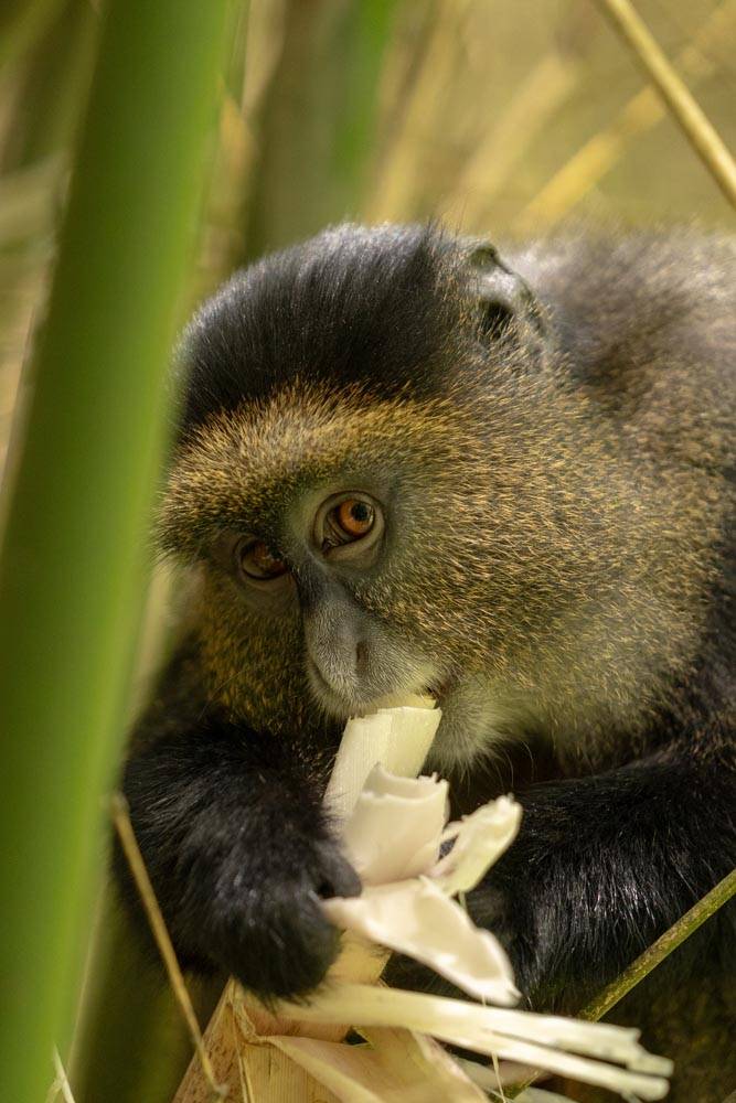
The main tourist attractions include gorilla tracking (only one gorilla family has been habituated here for tourism), golden monkey tracking, bird watching, cave exploration (ancient Garama cave), and the Batwa Heritage Trail. The three mountains of the Virunga volcanoes, Mt. Muhabura (4,127m), Mt. Gahinga (3,474m) and Mt. Sabyinyo (3,645m), provides a good challenge to mountain climbers.

Species diversity:
76 mammals, among which are buffaloes, elephants, giant forest hogs, bushpigs, duikers, leopards, civets, golden cats, jackals and porcupines have their home here. Because of the difficult terrain and the fact that most of these animals are nocturnal, they are rarely seen. At least 127 bird species have been recorded. The park also provides a habitat for the rare and endangered golden monkey.

Size and accessibility:
Mgahinga covers only 33.7 km² and lies in the most south westerly corner of the country, bordering Rwanda and Congo.

By Car:
A drive from Kampala takes about 10 hours.

By Air:
Kisoro is the nearest airstrip and regular flights from Entebbe are scheduled.

Activities:
Gorilla tracking and habituation
Golden monkey tracking and habituation
Nature walks
Cave exploration
Mountain climbing

Experience With Kikooko